If you’re lucky enough to be in the mountains, you’re lucky enough!
Showing posts with label Beaujos Pizza. Show all posts

Sunday, July 17, 2011

Another One Bagged: Bear Peak, Boulder, CO

Following a week of unstable weather with hot temperatures and evening storms, some quite violent, the weekend was calling for HOT and no rain - ugh!  Saturday morning we were out really early for a good tempo run on Santa Fe Trail - had to beat the heat, so we were off the trail by 9 am.  No time for pics, either :)

Sunday, we had an "appointment" in Boulder to meet up with Tim for a run, then have lunch to chat about crewing him during the Leadville 100.  The original plan was to run some nice trails in Flatirons Vista and Doudy Draw trail areas south of Boulder.  However, with the forecast high of 96 in Boulder, that plan got scrapped in favor of a less exposed, more forested route.  There is a trade-off:  The less exposed route is also quite steep....
 Starting into the Bear Canyon Trail


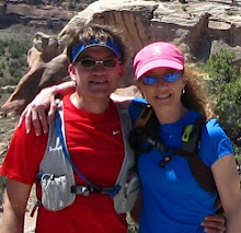
We started up the Shanahan Trail, climbing at a good rate but just seasoning the legs for the GOOD stuff to come.  Even with the 7:45ish start (yes, that meant rising at 5:15 on a weekend morning to drive to Boulder!!!), it was warming rapidly down on the southwest side of Boulder.  Fortunately, we were soon into the trees which provided a nice canopy for a large portion of the run.  From Shanahan, we caught the Mesa Trail and took that over to the start of the Bear Canyon Trail.  This is a very nice trail that ascends the canyon between Green and Bear peaks.  As seen above, it was a beautiful day.  We made our way up the Bear Canyon trail and then decided to see some new terrain and headed over toward Bear Peak.  The Bear Peak West Ridge trail starts to get a little more aggressive and it is apparent that it is traveled less frequently than the neighboring Green Mountain trails.  BTW, the trails are all shown on this map.
 Tim running the West Ridge trail - did you know this guy did Hardrock last week??
He even let us hold the buckle.....
 Kathleen on a nice section of the West Ridge trail - she went rockstar today!!
 South Boulder Peak - the highest of the Boulder Skyline peaks
 Views are constant - The Continental Divide from one of the lower flanks of Bear Peak

After several runnable sections on the West Ridge trail, the ascent of Bear Peak becomes predominantly a struggle for survival good power hikeThe back side from which we would summit is all rock, so there is a lot of natural stair climbing.  Topping out at 8461', the summit of Bear provides stellar views:  Longs Peak to the northwest, the Continental Divide to the west, and Boulder and beyond to the east.  Spectacular - once you catch your breath.  At only a bit over 5 miles into our "run", we had already gained a whopping 3075' elevation - yowsa!
 Behind the tree and below the Flatirons, NCAR is perched on the open hilltop
 Longs Peak framed nicely by the trees

Time of day and rising temps caused another change of plans here.  The original route would have called for us to drop off Bear into Shadow Canyon and run it out to the bottom end of Mesa, then take Mesa back up to our trailhead.  This would have left a pretty good clip down low to run exposed to the sun.  So we were duped into followed Tim and dropped off the summit on the Fern Canyon Trail.  We have done a steep trail or two in our day.  But this thing is ridiculously steep.  We clipped off the first 1000' of descent in about three quarters of a mile - commence quad mashing session!  We followed Fern all the way down through the shaded canyon until we dumped out onto Shanahan again.  When we first came out of the trees in the last mile or so, the heat hit you in the face right now.  We were glad that the alternate route was chosen because that roll across Mesa would have been ROASTING!   The route ended up at 8 miles - a poor indicator of the work that it was!  A very scenic route nonetheless and did a nice job of prepping us for our next stop:
I was remiss in getting a group photo, so I had to dig deep in the HT photo
archives for some mug shots - a perfect collage with our favorite Boulder eatery!!!

No better way to refuel beat up legs than to head over to Beaujo's for some fine PIZZA and salad bar!  We sat around stuffing our faces and chatting up crew duties at the Leadville 100, now a quick 5 weeks away.  After his experience at Hardrock, this could be a great course for Tim to roll really well.  We're looking forward to it.  It was 91 when we left town, don't know if Boulder hit the upper 90's but it had a good start!  We had a great day and Tim delivered the goods on the trail tour as always!  Happy Trails!!

Shoes - K Columbia Ravenous
S - Montrail Masochist
T - Hoka BondiB

>>>>>>>>>>>>>>>>>>>>>
Just a quick update - if you recall, Kathleen had mentioned a while back that CU Boulder grad Michaela Cui was doing a charity ride from Alaska to San Francisco to raise awareness and funds for The Graves Disease Foundation.  A local television station in California did a news segment highlighting the ride - it can be seen here.  Michaela and Chris will be finishing the ride on Wednesday and celebrating in Crissy Park after crossing the Golden Gate Bridge - Congratulations after 3200 miles on the bike!!!

Sunday, September 12, 2010

A Pretty Good Week

Falcon Trail Holiday Run
Blodgett Peak from Falcon Trail

It is unusual for me to run on Mondays, however, bonus holiday mileage is always a plus.  On Labor Day I headed over to the US Air Force Academy to take in the Falcon Trail.   Kathleen decided to stick with a bit lower mileage at Ute Valley Park to try and take it easy on the hips and legs, so it was a solo run.  It turns out, I was not the only one with the bright idea to head out to Falcon - it was a freeway on the trails!
Hello Mr Bull Snake, thanks for the brown shorts!!!
The Cadet Chapel
Wonderful Trail!

It was an incredible day with typical Colorado Fall weather - crisp morning, bluebird skies, and pleasant temps during the day.  Even with the trail traffic and two long days in the legs, I had a great run (aside from missing K) and felt really solid the whole time. 

13 Miles, 1800' elevation gain
Shoes - Pearl Izumi SyncroFuel XC
Post-run Starbucks - Happy Trails revved up!


Who stole Summer?
Saturday morning on weather.com - what?

Saturday, Kathleen had to work and she got out early for a run near home.  I was up really early and headed for Boulder to meet Tim for a run and help him move into his new digs on the east side of town.  Before leaving, I was horrified to see the above reading on the weather channel.  Wasn't it just last week that we were needing to get up at the crack of dawn just to beat the 90 degree temps???
Dowdy Draw Trail
Eldorado Canyon

(I neglected to bring my camera on the run, so the two photos above are public domain from various OSMP web links.)  Tim and I had a great run on some of the southern trails in the Boulder OSMP trail system, hitting Dowdy Draw, Springbrook, and Goshawk before taking Rattlesnake Gulch into Eldorado Canyon State Park for a short grunt up Eldorado Canyon trail before turning around and heading back along mostly the same route.  Tim is busy training (and stressing out over) for the Bear 100 near Logan, Utah in two weeks.  So we did a nice "recovery" run before his last big run in preparation for the race.  Of course we were hungry, so we moved some stuff to the new place, then hit up Beaujo's Pizza for a little salad bar and Prairie Pie - oh yeah!  

We had an interesting chat about logging mileage for trail runners.  In typical, normal running circles, output over time is logged with straight numbers - mileage run and time spent.  However, as is the case with so many trail runs, there are significant variables that can make a 15 mile run take 3 hours, which on a running log, looks really bad.  Significant accumulated vertical gain, extreme technical footing, and raw starting elevation all conspire to make mileage a secondary factor.  So if you run trails, how do you account for these factors when you log your runs so that 6 months from now, you will know what your Effort was?

14.6 miles, 2650' elevation gain
Shoes - Pearl Izumi SyncroFuel XC

Fantastic Day at Cheyenne Mtn
Part of NORAD's Antenna Farm atop Cheyenne Mtn
-keeping an "eye" on the Western World!
Sunday morning we headed to Cheyenne Mountain State Park for a little trail activity and brilliant sunshine.  Another gorgeous day was on tap and we have to take advantage before old man winter shows up.  Had a nice view of the gobs of aerial devices atop Cheyenne Mountain from the parking area.  If our blog disappears, you know I photographed the wrong ones.....
You again???

For the second time in a week, rounded a bend to find a well-fed bull snake sunning on the trail.  This guy was more bashful, retreating hastily before I could get the camera out.  These are one of the more common snakes we see and are not venomous, but can be large and intimidating.  This one was a bit over 3 foot long I would guess.  If you are not a large insect, rodent, small bird, or lizard, he is most likely not at all interested in your company!  They are hoarding for winter right now, so watch your step.
Kathleen enjoying the Sundance Trail...
...Steve was, too!
 Trail with a view
Heading into the Rock Garden
Nice forest photo
Parting Shot of the mountain

Once again, it was an awesome day to run trails in Colorado.  We had a great time at the park, headed home  and enjoyed a cold soak for the legs, followed by a leisurely afternoon with the return of NFL on Sundays. Happy Trails!
12 miles, 1725' elevation gain
Shoes - K Asics 2150 Trail
S - Pearl Izumi SyncroFuel XC

Sunday, July 25, 2010

Peak Bagging - Green Mountain

Decided to head up to Boulder on Sunday for a run with Tim - run some of his "slow" miles while he is recovering from last week's 50 miler.  Here was a brief overview of the emails concerning the run:
Steve: what are you thinking about tomorrow?
Tim: got an adventure planned for you guys  {red flag}
Steve: ?
Tim: 3 hours easy pace with amazing trails and views
 ~ an hour later
Tim: uh, by the way, the run has about 4000 feet of climb, just so you know {red flag confirmed}

We knew what we were getting into, so we were up at the crack of dawn and headed for Boulder! 
Kathleen and Tim - Mesa Trail

Headed out from Tim's place for some miles before the day's main attraction - Green Mountain.  Rolled out on some nice connector trails until catching Mesa Trail for the cruise over to Chatauqua Park.  It was an awesome, sunny morning, especially considering the low clouds, cool temps, and drizzle we left behind in Colorado Springs - what a difference 90 miles makes!
Steve rolls across Mesa Trail

Mesa Trail is some very nice running, including sections to the South that we had run previously.  There is great scenery with lots of high meadows full of wildflowers and a stunning  skyline to the west as you roll along the base of the Boulder mountains.
Surveying the Flatirons

Once we arrived at Chatauqua, it was time to survey the real work ahead.  With around 5 miles of climbing/rolling terrain to soften up the muscles, the serious business of the day loomed ahead.  From the scenic view of the Flatirons above, we would connect through the upper meadow over to the base of Green Mountain.
Looking north past Flagstaff to Mt Sanitas
Ground Zero - The Official start to Green Mountain

Starting up Green, the "uh, by the way.." portion of the email hit full on.  The route we took up Green was just over two miles with 2400' climb - stout no matter how you stack it up.  Time to get to work!!
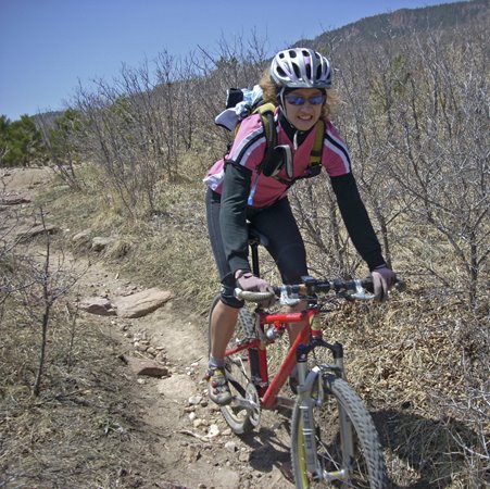
Some of the early "trail" ascending Green Mtn
Looking out across Boulder from part of the way up

While we are accustomed to climbing steep terrain, there is always something "extra special" when climbing new trails and not knowing when the pain climb is going to end.  This climb is no exception - you do not baby your heart rate up this kind of climb!  So we put our heads down and plugged away - the next thing you know, we're at summit - sweet!
Looking West - top of Green
At the summit post - Green Mountain
Panorama from Green Summit

We spent a little time taking in all the views from the summit of Green.  It was an awesome day, but a wee bit hazy making some of the distant skyline a little fuzzy in the pics.  About one third in from the right on the photo above, partially shaded by a cloud, is Longs Peak in Rocky Mountain National Park.  After soaking up some jaw-dropping vistas, it was time to drop in for a big time descent off the saddle of Green Mtn into Bear Canyon.
Steve running a meadow in Bear Canyon
Kathleen high on a ridge in Bear Canyon

While the descent was quite steep at first, the run down through Bear Canyon has very manageable grades and fantastic footing for the terrain we were on.  There were some nice new trails cut in Bear Canyon since we were last there a couple years back.  The new switchbacks made the runouts a little nicer and the overall descending experience much better.  
From Bear Canyon - looking back at the start of our climb

As we ran out the last of Bear Canyon, we had a great overlook to the start of the climb from earlier in the day.  After about 3 miles descending, we dropped out on the service road and had a steep pitch back up to catch Mesa Trail.  After another short climb on Mesa, it was a nice descent all the way to the finish.  No questions, this was a tough outing for a run of its length.  However, there were some killer views and lots of nice trail to go along with the hard work.

Stats: 14 miles, 4400' elevation gain
Shoes - K Saucony Guide Trail
S - Asics Trabuco
After we finished, we got cleaned up quick and headed over to Beaujo's Pizza, a Colorado tradition known for its Mountain Pies and a pizza place that is Gluten-Free friendly.  We inhaled some high quality replacement calories and enjoyed our time chatting about future trail exploits - good times!
Happy Trails to everyone this week!
Related Posts with Thumbnails