 Today we drove up to the mountains west of us and ran at Rampart Reservoir. We ran this a couple times last year, however we parked at the dam. This time we parked at Rainbow Gulch trailhead on Rampart Range Road and ran it as a lollipop loop. Given the late spring we had and the late snows in the high country, the water is still pouring into the reservoir - this is good.
 So here is the aerial map of what we ran, with a clockwise direction for the loop. The loop ranges between 8990' and 9315' elevation. The trail is almost always above and next to waterline, except in some of the tributaries where it is routed farther inland for high water. The long straight section on the east end is the dam road. This is a taxing run mentally and physically because there are no extended climbs or descents, yet nothing is flat - a lot of up and down rollers which make momentum a definite mind game.
 Starting in toward the main body of the reservoir with the brilliant morning sunshine glistening on the water. That is the first of many boats we would see on our run.
 About halfway around the northern shoreline, the first views of Pikes Peak appear between the trees - just never get tired of that view!
 At the end of one of the outstretched fingers of the reservoir, Steve emerges from one of the bog areas - roots, logs, and always muddy. These areas never get much more than slivers of sunlight for any extended periods during the day. Hope you brought your bug spray!!!
 Rounding this corner, the first full views of the entire Peak grab your attention - sharp left turn or you'll run right off the edge into the drink! The mountain is way more impressive seen from the north like this - one enormous piece of granite!!!
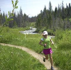
 Steve runs through one of the few open meadows along the trail, dwarfed by the stunning landscape - the views on every section of this trail can take your breath away.
 Kathleen crosses the bridge to complete the loop proper - now it is back up the hill on Rainbow Gulch to the trailhead. Finish with a climb?!?!?!
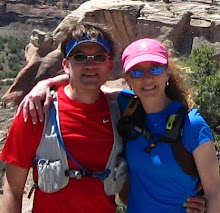
 A kind mountain biker offered to take our picture along the stream before we headed up the hill to the truck. It was a fantastic run today - AND - Kathleen's longest run ever!!! She is finally getting her legs back!
Happy Trails!
Today's stats (as requested by J.B.) :-)
Shoes - Asics Trabuco
Mileage - 15
Elevation gain - 2600'


