If you’re lucky enough to be in the mountains, you’re lucky enough!
Showing posts with label Rampart Range Road. Show all posts

Saturday, May 21, 2011

A little new scenery (and some familiar!)

Been a bit since a post here but we're still running!  When we got back from the desert a couple weeks back, we took a mountain bike ride one day and then headed out to Limbaugh Canyon for a sweet loop we have done a couple times.  Only we forgot how brutally steep the climb was on Trail 715 - especially on tired legs from those fantastic runs in Fruita!!!  Not really sure what to think of Limbaugh - anyone know what the "secret" is there, feel free to fill us in.  Those two runs from the fall are the MOST SEARCHED posts ever since we started blogging.  What's up with that?  Must be the Bermuda Triangle of the mountains or something...

Anyhoo, the last two weeks have been the part of Spring that everyone savors in Colorado - RainSnowFogSleetHailWind - a very annoying weather pattern.  Last weekend we had two long runs in rain/drizzle conditions and cold, so we were not in the "sharing" mode.  You can thank us.  Had some life stuff thrown in with it too and cleared that, so it was time for some good weather in time for the weekend and back to good runs. 
Out early enough to run with the moon!

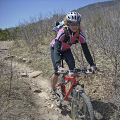
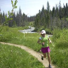
Kathleen had to work today, so we were out pretty early to get some good miles for her pre-work.  Since we had nice weather and an early jump, we decided to get in some exploration.  For a while the "Scar" has been on our docket for a little exploring.  You have seen it in our pics before - the long, flat scar that was formerly Queen's Canyon Quarry and is now reclaimed.  Technically, the road up onto the scar belongs to The Navigators.  However, it is used a great deal by local hikers and runners.  There is a nice flock of bighorns that live up there - steep canyons are their deal, you know.
Heading into the canyon - Scar is in the distance still
Up onto the mining road now - Tiny Kathleen in a Big Canyon!!!
Fascinating rocks and meadows on the way up
Just a little farther...
Looking down on Glen Eyrie
Posing with the Canyon's mascot

We climbed for a while to the bighorn statue and had to head back down so Kathleen could get to work.  We will certainly be back to check out the rest of the Scar in the near future.  The climb is manageable and the scenery is certainly not what we expected once we got back in there.  There is supposed to be a trail off the far end of the scar that heads all the way over to the old plane wreckage that sits behind Blodgett Peak, as well as a trail that heads up to Palmer Reservoir.  Exploration awaits...
Cruising the descent
Down through the canyon
Some great scenery

After dropping out of Queen's, Kathleen headed off for the climb back over Flying W to home, and I rolled into the Garden of the Gods to continue the run.  It was starting to warm nicely by now, a welcome change from the last couple weeks!  Soon after hitting the Dakota trail on the front of the Garden, I ran into Jonathan & Tammy running their "backyard" trails - funny we don't bump into them more often.  Chatted a bit and was surprised to find out that they have not been running the scar as Jonathan was almost ticketed last time up because they are in the midst of a study on the bighorns - Ooops...  Might explain our solitude up there!  Good to see them again - they are racing on some sweet trails down at the Sage Burner in Gunnison next weekend - good luck!!
Still one of my faves - Siamese Twins
  Pikes Peak - crowned with clouds most of the day

I rolled through the Garden with my intent to run some things reverse of normal route - heading UP Rampart Range Road to the water tank, then descending the singletrack that is usually a laborious grunt from the Garden side.  This was the first run up RRR and, while quite manageable, it is still a task and requires some concentration on the pacing.  It is just under three miles to the tank, where you leave RRR, climb a goat path past one of the city water tanks, and gain the ridge high above the Garden and south of Queen's Canyon.
Top of the Scar, just past the hill in the forground

It was interesting to look out from this vantage point to the scar, seemingly forever away, when I had just been on it 90 minutes earlier.  It was not until on the ridgeline that I noticed that distinct singletrack across the hillside - need to find out about that too!
On the ridge, looking out at Cedar Heights - those poor folk have horrible views, eh???
Took this video while running across the ridge to the drop in for the Garden.  Hope it is not too shaky -the wind was gusty up there, so no commentary during the vid either.  This is about 800' feet or so above the Garden, so you get some pretty nice views.  Rolled out through the middle of the park, which was by now packed with people on such a great day.  Made my way up and over Flying W and home, rolling into the casa with just shy of 21 miles and 3800' of climbing.  Not a bad way to spend a Saturday morning.  Kathleen had rolled in a while back with 11 miles, which is also great for a morning run before heading off to work.  Hope all is well and might be back tomorrow with some more fun stuff.  Happy Trails!

Shoes - Saucony ProGrid Mirage

Sunday, March 20, 2011

Longest...Run...Yet

It has already been a good week of running and the weekend, the source of the majority of my quality runs, is only half done.  With the DST bringing wonderful daylight to my post-work hours, two nice runs were already in the bank before the weekend hit, including a good outing Wednesday where Kathleen and I enjoyed 64 degree running temps after 6 PM.   After that run, we were talking at dinner and I said - I think I'll shoot for 20 Saturday.  Now, for most of you, that is no big deal.  However, for quite some time "20" has been one of those mental blocks.  You must remember, most of our mileage is exclusively on dirt and there is nothing flat in Colorado, so this is not your average long run number.  Anyhoo, I had it in mind all week to break through that ceiling and the weatherman was really helping my cause with the weekend forecast, now I just had to decide where I wanted to run.  Kathleen had to work and so it was going to be a solo outing, so non-boring had to be a part of the equation.  Originally I had eyeballed Spruce Mtn / Greenland area because the big loops provide an easy outlet for long training runs.  However, I decided to run from our front door, through the Garden and up into Pike Nat'l Forest, then catch Rampart Range Road, back through the Garden and home.  I was hoping my calculations would work out, and was glad we hopped in on this run back in January as it provided beta on some extra goods above the Garden that we never knew about.
New singletrack in Blair Bridge Open Space
Above the beaten path

So the run starts out a bit on the urban side, following the trail along Flying W road up and over, then catching the bike path along 30th street to get over to the Garden.  For whatever reason, I always dislike running the blacktop bike path, so I hopped off onto some fresh singletrack we have seen in passing which headed up to the trail connector for the Blair Bridge Open Space.  There was a nice view from the ridge and it helped cut out 1/2 mile of pavement so that was cool.  I was wearing the pod early on for a little distraction, but when I crossed under 30th and dropped onto the trails in the Garden, that got stashed in the pack. 
Weathered remnant
Looks like the Peak is just over the crest...

After exiting the Garden above the Palmer trail, I continued on the trudge up to gain the ridge above Queen's Canyon.  Certainly the most taxing climb of the day, I was reluctant to push hard because I was only 5 miles in.  So I hiked a coupled of the game trails that go straight up the ridges.  It wasn't long before I turned back to these views:
Far above the Garden on the ridge
And to the north, Queen's Canyon and Glen Eyrie - 
the Castle is almost dead center of the photo if you can pick it out!
Over the hill, and there is snowcapped majesty

Made my way up the ridge and over to the lookout for Queen's.  Then it was a steep drop down past the water tank (off the right edge of the photo above), and I rolled out onto Rampart Range Road.  This is an old dirt road that starts in the Garden and travels along the spine of the Rampart Range all the way to Sedalia, just southwest of Denver.  It is of variable surface, but generally is not a regular car road.  It is mostly frequented by:  A - Recreational users headed for various rec use areas.  B - Those members of society looking for a place to hang out and get drunk, stoned, or otherwise abuse their bodies.  C - Worthless punks looking for natural scenic wonders to deface with graffiti, whose hands I would most likely cut off if caught in the act, but that's another story for a different post.   Since B & C are generally out under cover of dusk, mostly was watching out for A as those folks are sometimes distracted by destination rather than focused on other people on the road (ie, me!)   It is about a 3 mile descent on RRR and then you are back in the Garden.
The first balanced rocks you see on RRR - not many tourists 
here because you have to walk more than 20 feet from your car.
Then the Balanced Rock that everyone visits!
Sorry Renee, but this is the best Saguaro I could come up with :-) Kathleen was impressed!
Ah, the Garden!

It was good to be back down in the Garden.  I had a pretzel shaped loop in mind to run in order to snag some of the favorite trails.  It was also quite warm.  I started at 38 degrees and had ditched the light wool long sleeve up on RRR.  (When I finished, it was 65 at the house - sweet!)  It was surprisingly light for traffic on the trails considering the awesome conditions.  Rumor has it around 15 miles, I hit a low spot.  However, since I was by myself, this cannot be confirmed....
View from the Vistor's Center front door - good office view, eh???

I stopped by the visitor's center to fill my pack as I had gone dry about a mile back.  Ran into a mountain biker filling his bottles and we chatted up about the unfreakingbelievable weather.  Ate a gel, plugged back in to some tunes, and headed out of the Garden and back toward home.  I was growing a bit tired, and still had a bit of climb before hitting HT central, so I still had some work left.  The mile and a quarter grind up Flying W was certainly rough.  However, the haunting riffs from Mark Knopfler's frets on Dire Strait's "Brothers in Arms" soothed my mind on the climb and pulled me over the top.  Then some serious blistering tunes (including something from the Scorpions I haven't listened to in 20+ yrs...) drug me the rest of the way home. 
Home at last - these puppies carried me 21.03 miles
 Profile of the run
50,000 foot perspective

Made it home and stopped the Garmin at 21.03 miles - longest ever by far.  It was a great run and, while tired, nothing hurt and I was in relatively good shape!  I really enjoyed this, and it probably helped cement in my mind that I'll try out a 50k trail race this summer.  Seems kind of odd to skip a marathon in the progression, but since I'm not a pavement afficianado, such is life.  There is a possibility that this guy might even tackle the formidably frustrating task of attempting to coach a  non-structured runner such as myself through just such an event....we'll see ;-)  It was a great day - nothing spectacular for a lot of you I realize, but I had a blast and jumped that "hurdle"!!  Hopefully the next one will include my lovely bride!!!  Not sure what the legs will have today, but it's all icing after yesterday...
Speaking of icing, Kathleen stopped at Boonzaaijer's on the way home.... A little
Black Forest Roulade to congratulate and help "recovery" efforts

Shoes - Pearl Izumi SyncroFuel XC
Wore the McDavid Sleeves again - very nice
Stats: 21.03 Miles, 3479' elevation gain
Related Posts with Thumbnails