...But First, Where Have You Been?....
Haven't posted in a bit?? I know, not because of a lack of desire. Just have not been up for it. Back up a few weeks and I'll give a brief explanation. Coming out of the Greenland race, we both felt pretty good. Had a decent showing there and headed off to sunny New Mexico to try and get spring jump started. By mid-week, I thought I had a slight groin strain from the race, so tried to keep an eye on it and do some stretches, etc. However, not a strain. Let's just say strong antibiotics and very painful and we'll leave it there. It has left me on the non-impact, unable to run list. So, ...

Sidi Dominator - worth buying for the name alone!
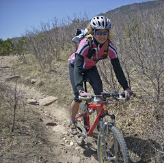
At the end of this week, I got out the trusty mountain bike and figured I would find out if I could at least tolerate some rides. Ride 1 short but good on Friday evening. Saturday morning, Kathleen ran by herself before heading off to work. She got in a nice 9 mile run, incorporating some of our local hills. Good run and all seems to be clicking for her - awesome! After she left for work, I headed over to Santa Fe trail to try some mileage on the bike.
Nice view of Blodgett Peak, with the tip of Pikes Peak behind, and the B-52 display in the foreground.


Headed out 10 miles to the north boundary of the Academy and then had headwind the whole way back - yeah... I am talking the nice, sustained 35 mph with 50 mph gusts - awesome!! Just what you live for on the bike - or NOT. But, it's Colorado in the spring and you learn to suck it up, bury your head, and go. I ended up with 20 miles in relative pain-free fashion - good news.
NOW, Run with Jill!

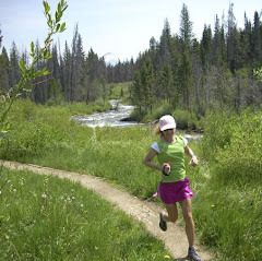
Kathleen and Jill
Kathleen had been chatting with Jill post-Boston about doing a trail run with us. So a run was coordinated this week to take place at Waterton Canyon outside of Littleton, CO. The trail is a wide dirt road that follows the South Platte up to the Strontia Springs Dam. It is a very scenic canyon and there were many trail users already out early this morning. The plan was for Kathleen and Jill to run and I was going to ride the bike - better than staying home, right? Jill also had a friend, Dennis, that showed up and ran with them most of the way.

Tried my hand at video while riding

Most of the ride up was shaded, as the sun had yet to clear the canyon walls - a bit cool but still pleasant out.

Stopped to have a look at the dam when I reached the top. The dam is 243 feet high and I was quite happy it held it's contents while I was below it!!! I knew I would have a bit of extra time, so I continued on toward the start of the Colorado Trail.


We have been on several segments of the Colorado Trail, which starts here and goes all the way to Durango, but have never been to either endpoint - until today. I rode a bit up the singletrack, which was quite steep, and then turned to start back down. We will be back to run this and get in some more of the singletrack trails!!!


I saw Dennis on my way down and knew it was time to keep my eyes open for the gals. Sure enough, along came Kathleen and Jill - both all smiles and enjoying their day. Notice their synchronized running - almost like they practiced it for years!! Once again, we had some unbelievable weather. We went from two days snowing last week, to 80 degrees Saturday and 75 today - gotta love the mountains. I continued on down and chilled in the sun for a bit while the gals finished up a nice run. It was a nice day and we were glad to meet Jill (& Dennis too). More "Kathleen Commentary" coming tomorrow.........
Back in Time...

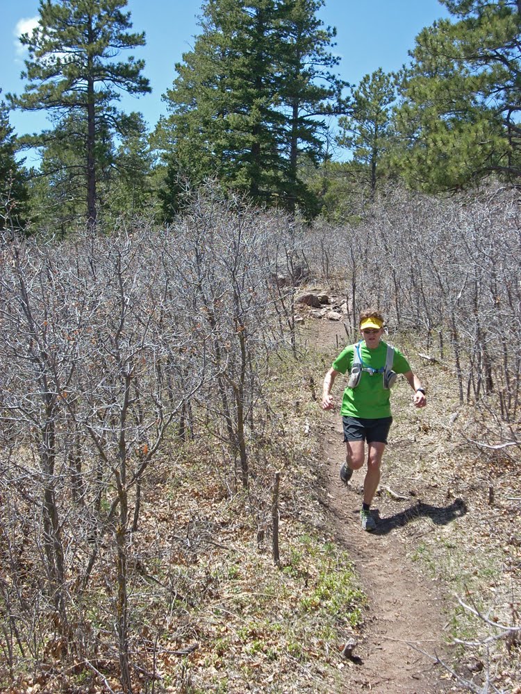
Quick rewind to last weekend - we got out for a run at the Monument Fire Center, trying to get a preview for a big loop we want to do in the near future. With many rides under our belts on these trails, and some local recon info from our friend Jon (whom you met several posts ago), we decided to expand our base a bit and go a little higher up on Mount Herman. Kathleen is cruising up into the alpine section here on Trail 715. We are looking at an option to form an 18-20 mile loop utilizing these trails. Trail 715 will form the "spine" of our big loop, as it traverses the southern and western flanks of Mount Herman.


We thought we were taking the newer Black Pearl trail, however, my navigation was a bit off and we were on the 715 all the way up to an intersection with Mount Herman Rd. That worked out OK, though, as we realized the potential for the circumnavigation of Mountain Herman. We topped out around 8000 feet but will need to climb higher to complete the big loop. With more navigation resources from Jon, we will be looking at that in the near future.
Because of the "issue" previously mentioned in this post, we decided to cut off the exploration for the day and begin our descent back to the Fire Center. As we made our way down, we were excited about the potential loop even before we got to sit down and scour the map.

We finished our day with 11 miles but are hopeful to get back over soon and take a shot at the big loop. Watch for details....