If you’re lucky enough to be in the mountains, you’re lucky enough!
Showing posts with label Rampart Reservoir. Show all posts

Monday, June 27, 2011

Beat the Heat at Rampart Reservoir

 Early morning sun on Rampart Reservoir

Saturday was a photo-less long run day so you will have to visualize for yourself...  Kathleen had to work, so we ran to the top of Mesa Road and she returned home to round out a 9.5 mile morning jaunt and tend to her duties.  I looped through the Garden of the Gods, down Ridge Rd and made a lap around Red Rock Canyon before returning home the same way.  20 miles and glad to be done before the big heat.

Sunday's forecast was for 90's, so we headed up Ute Pass to check on the city's water supply at Rampart Reservoir.  We had to get an early start or else miss out on parking spots at our favorite trailhead.  At 9300' elevation to start, the air is generally at least 10 degrees cooler than it would be at the house at 6800'.  It was an absolutely perfect morning with clear blue skies and mild temperatures - time to get rolling.
 Quiet bay
 Massive granite boulders are numerous along the trail

We like to start at the Rainbow Gulch trailhead and run down to the reservoir.  It means you have to finish with a climb, but it also makes the run a little longer :)  Early on in the run, we saw mostly fisherman down on the shore in various places, a couple runners, a mountain biker, and these folks:
 Kayakers enjoying the quiet morning
 Running some nice forest trails
 Views like this distract along the entire route

As we have said before, this is one of those "trick" runs.  Aside from the raw elevation, this trail has no extended alpine climbs nor does it have abundant technical footing.  However, the constant jaw-dropping views and incessant ups and downs that come with running the the shoreline of a mountain reservoir place a drag on your concentration, and eventually, your energy reserves.  There is a constant struggle to push an even pace - so this is a good mental training run, although the reservoir usually wins the struggle....
 Kathleen cruises the scenic trails
 Once again - views on the right, wait...watch your step...
 Looking out from the dam - the sharp point left of center is Blodgett Peak

Standing on the dam, looking out across the ridge you can see a wee bit of the sprawl that is Colorado Springs.  Here is the odd thing:  it is about a 28 mile drive to get to the trailhead from our house.  Blodgett Peak is only about a 3-ish mile hike from our front door.  From Blodgett to the reservoir, as the crow flies, is maybe 3 to 3.5 miles.  So you start wondering, if there was a good route, why not just bust over the hill from home, trudge up to the reservoir, run a lap, then run home???  Hmmm, maybe some time pouring over the Ormes Pikes Peak Atlas map is in order...
 Back around to the inlet - plenty of snowmelt pouring in

After crossing the dam, the west side of the reservoir goes by in a flash as the 2.5 miles or so on that side seem so short compared to the length of the eastern side with the large inlets.  Running through the forest, more and more light peers through, the sound of rushing water tickles the ears, and then you pop out of the trees along the inlet, ready for the climb out to the trailhead.
Stop for a pose

From the footbridge, it is about a mile and a half climb out, starting on sweet singletrack following the inlet.  At the end of the trail, it is back out onto a wider trail (more like a road) that is quite exposed - it was here we noticed just how warm it was becoming, and we were glad to be finishing, not starting as so many were.   The route ends up at 14.25 miles with just under 2400' climb.  It was a bit of a stretch for Kathleen, but she made it.  It was a great run - yet another that is so close to home!  We stopped in Woodland Park for some Starbucks refueling, then stopped on the westside of town to hit Rudy's BBQ for some awesome smoked turkey and green chili stew to repair some tired legs!!!  We were glad to have been up high - we hit 96 degrees in town, only 2 degrees shy of a record high!   Happy Trails!
Satellite view

Shoes - K Pearl Izumi SyncroFuel XC
S - Montrail Masochist

Sunday, August 1, 2010

Mountains, Lakes, and Trails!

Not that we don't always have good trails to run, we needed to get a couple of good, longer trail runs in this weekend in order to bolster our endurance for some late summer big runs we are eyeballing.  Saturday morning we targeted Cheyenne Mountain State Park, where we have not run for a few months.  Oddly enough for our alpine desert climate, Saturday dawned cloudy and HUMID, as in 89% humidity when we left for our run.  What?  Is this Mississippi?  Texas?  Nope, Colorado, and boy was it sticky. 
Most of Cheyenne Mountain was in a shroud of thick cloud when we arrived, except for this little point.  The clouds would come and go throughout the morning, however, the humidity decided to stay put and we were dripping sweat the entire run!
Running the Talon Trail
Kathleen on Talon North

We started on the southwest portion of the park and ascended to the Talons - a long climb through some diverse terrain that leads to two loops around the top - Talon North and Talon South.  We ran both and they are quite spectacular trails with great views - East to the prairie and west to some undeveloped land that now belongs to CMSP - future trails are in discussions....
Talon North Summit - thick cloud behind us!
Traversing the Sundance Trail over toward Blackmer loop

After descending off the Talons, we made our way across Sundance and looped around to the bottom of the Blackmer loop.  Time to climb again!  It was really starting to warm up and the thick air was weighing on us, so we decided to stay higher with more trees - good call.
Going Up - ascending the Blackmer Trail

Got up onto Blackmer and found some nice shady trails that were tacky and a bit damp from Friday evening's storms.  That is always a welcome change in this normally dry terrain.  We did an extra loop on Cougar's Shadow, then rolled back across the top of Blackmer before starting the descent toward the trailhead.
Kathleen cruising down the front side of Blackmer
Parting Shot - Still no summit view!

On the way down, we took a detour on the Medicine Wheel trail, one of the more technical in the park.  We figured we would keep our legs (and minds) honest to the very end of the run, testing our eye/foot coordination through and endless maze of boulders.  It was a blast and we finished our run strong but tired.  Very nice day on the trails!

Stats: 15 miles, 3000' elevation gain
Shoes: K - Saucony Guide Trail
S - Asics Trabuco

>>>>>>>>>>>>>>>>>>>>>
Sunday morning - cloudy again? Humid again? Yep, so we headed up the pass to Woodland Park and over to Rampart Reservoir.  By the time we were half-way up Ute Pass, we were driving into partly sunny skies - nice!  With the trailhead we use sitting above 9300' and the trail around the reservoir rolling at or above 9000', this run allows for some cooler temperatures in the summer and some good altitude training.
Spillway - and the start of the singletrack
Rushing water, wildflowers, and awesome trail

The trail starts up on Rampart Range Road and drops down immediately along the stream that brings water in off the mountains.  Starting on a dirt road, we soon pick up a nice singletrack and cruise on down to the start of the loop around the reservoir.  Surprisingly, we saw very few people on the trails today - odd but pleasant.
Above shoreline, running through the aspens
First views of Pikes Peak
Quiet Inlet
Kayakers enjoying some open water solitude and Peak views
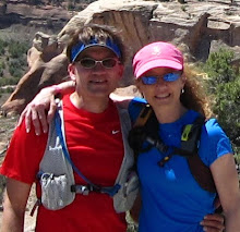
Happy Trails Duo

Once again today we had great conditions - last night's rains left the trails with a little more grip than normally found here.  With a nice mixture of sun and clouds, cool breezes off the lake, and the soothing sounds of water lapping the shore below us, it was a great day to be running trails (of course, we think every day is a great day to be running trails...).
Almagre Mountain (Baldy) on the left, Pikes Peak on the right
Satellite view of the route

Although accumulated fatigue from back-to-back tough runs was apparent by the end, we had another great day running.  Considering that a short half-hour drive puts us on the trail above 9000' elevation, this is a great little getaway right in our "backyard"!  Hope everyone had a great weekend - Happy Trails!

Stats:  14.5 miles, over 2500' elevation gain
Shoes - K Asics 2150 Trail
S - Asics Trabuco

Sunday, June 28, 2009

Rampart Reservoir

Today we drove up to the mountains west of us and ran at Rampart Reservoir. We ran this a couple times last year, however we parked at the dam. This time we parked at Rainbow Gulch trailhead on Rampart Range Road and ran it as a lollipop loop. Given the late spring we had and the late snows in the high country, the water is still pouring into the reservoir - this is good.
So here is the aerial map of what we ran, with a clockwise direction for the loop. The loop ranges between 8990' and 9315' elevation. The trail is almost always above and next to waterline, except in some of the tributaries where it is routed farther inland for high water. The long straight section on the east end is the dam road. This is a taxing run mentally and physically because there are no extended climbs or descents, yet nothing is flat - a lot of up and down rollers which make momentum a definite mind game.
Kathleen cruises the fine singletrack on the northwest shore.
Starting in toward the main body of the reservoir with the brilliant morning sunshine glistening on the water. That is the first of many boats we would see on our run.
Climbing out of one of the many inlets, the water is smooth as glass behind Kathleen.
About halfway around the northern shoreline, the first views of Pikes Peak appear between the trees - just never get tired of that view!
At the end of one of the outstretched fingers of the reservoir, Steve emerges from one of the bog areas - roots, logs, and always muddy. These areas never get much more than slivers of sunlight for any extended periods during the day. Hope you brought your bug spray!!!
Nice shot of the trail weaving through a stand of aspen.
Rounding this corner, the first full views of the entire Peak grab your attention - sharp left turn or you'll run right off the edge into the drink! The mountain is way more impressive seen from the north like this - one enormous piece of granite!!!
On the southern edge, looking back toward the dam.
Steve runs through one of the few open meadows along the trail, dwarfed by the stunning landscape - the views on every section of this trail can take your breath away.
Kathleen crosses the bridge to complete the loop proper - now it is back up the hill on Rainbow Gulch to the trailhead. Finish with a climb?!?!?!
A kind mountain biker offered to take our picture along the stream before we headed up the hill to the truck. It was a fantastic run today - AND - Kathleen's longest run ever!!! She is finally getting her legs back!
Happy Trails!

Today's stats (as requested by J.B.) :-)
Shoes - Asics Trabuco
Mileage - 15
Elevation gain - 2600'

Sunday, August 3, 2008

Rampart Reservoir Trail

We decided to avoid our record high temps from the past few days and go to a little higher elevation to run the Rampart Reservoir trail. At 9000', we knew it would be at least 10 degrees cooler at the reservoir added to the cooling effect of the water.Whenever we drive through Woodland Park, we "must" stop at the Donut Mill for rocket fuel, or in this case the mother-of-all-cinnamon-rolls! Given the fact that Kathleen is losing the sweet tooth (other than CHOCOLATE, ...and Steve never really had a sweet tooth) we may be nearing the end of our Donut Mill tradition.
It was a beautiful day with very nice temperature and a slight breeze off the water. The water is down about 15 feet from when we last ran here, but that is not too bad given our extremely dry summer this year.
Kathleen crosses the stream - it is good to still see water coming in, as we are needing to draw so much from the reservoir for Colorado Springs' water supply. It was also cool to see a few boats out fishing today, which means they must finally have the Zebra Mussels under control.
Perfect opportunity for a group photo on the bridge! Too bad this spot is only 4 miles into the run, as this would be a great spot to cold-soak the legs after a hard run! We may have to try a re-route next time and take advantage of the natural refresher!
Steve rounding the shoreline - you can see where the water has receded in the background.
It is always nice to have a backdrop like Pikes Peak to frame a photo. Purple Mountain Majesty was definitely in full glory today! It was another great day of running combined with awesome views along the way. This 11.5 mile loop is quite a trail running gem and we would suggest it to anyone that wants to try something a little ways out of town. As always on a great day in the mountains with awesome trails under foot - Good Times!

Saturday, June 7, 2008

Stunning Rampart Reservoir Trail

One of the key links in the Colorado Springs water supply chain, Rampart Reservoir sits at 9000' elevation in the Rampart Range approximately 17 miles up the mountain from town and has approximately 500 surface acres. From the eastern shores of the reservoir there is an awesome perspective of the grandeur of Pikes Peak. While we have enjoyed this trail by mountain bike in the past, today would be the maiden voyage as a trail run. Traffic was light today for a summer day, however fishing is limited and boating prohibited right now because of problems caused by growing numbers of Zebra Mussel. These thumbnail-sized critters like to clog water lines and water pumps in the system that brings water to town - not good!
Above is a nice shot of Kathleen running on the western shore of the reservoir. We started at the eastern end of the dam wall and headed west, so the western shores were our first trails of the day. We don't get much water time aside from small streams, so this was a good "water-day" for us!
Found a nice ledge for a group photo which always helps - this was right past the foot bridge where traffic merges in from the mountain bike trailhead off of Rampart Range Road. This is also the spot where water comes in from the pipeline off the Continental Divide, many miles to the west.
Steve enjoys the nice flow of trails and the great sunny day we had!
One of the many inlets that the trail follows along the shoreline. While there are no major climbs, this trail is a continual flow of short ups and downs (see profile below) that begin to sap a little from the legs. The 11.5 loop gains an accumulated 2250' elevation, and when combined with a base elevation exceeding 9000', this is a challenging (but extremely fun!) run.

Tomorrow is forecast for clouds and much cooler, so we were very thankful for such great trails on which to spend a sunny day in the mountains - good times!
Related Posts with Thumbnails