We hit the road today - on bikes, don't get your hopes up you roadie runners out there - to get in some miles while the Leadville 100 mountain bike race was taking place up in the thin air above 10,000 feet. Congratulations to Levi Leipheimer, winning in a new course record time, and Jeremy Horgan-Kobelski finishing second and also dipping under the old CR. The course record was not soft, either, as it was previously held by Lance Armstrong. Imagine riding 100 miles, mostly above 10,000 feet elevation, in 6:16:38 ??? Next Saturday, they'll line up in Leadville again, only this time for the 100 mile running race.
Panorama looking over our "neck of the woods"
It was another beautiful day and absolutely perfect for a ride. We started the day with cloudless azure skies and pleasant temps in the mid 70's. We just stayed on the quiet roads around home and were hoping to get in 20 miles or so of relatively easy spinning.
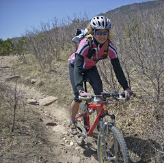
Kathleen riding, with Blodgett Peak on the right
All done and ready for some grub....
We had a great ride - 24 miles with some good climbs. After watching the live updates for the finish at Leadville and seeing the top 5 come in, we got cleaned up and headed out for some fuel replenishment. We dropped in to Coquette Creperie in Manitou Springs, a great restaurant that serves a wide variety of gluten-free fare. We had our server take a photo, however, it was a little dark and was vetoed by one half of HT for hair malfunction issues.... :-) I had the South of the Border, which is a large crepe stuffed with eggs, chorizo, pico de gallo, jack cheese, and is served with home fries. Kathleen had the Monte Cristo, which also starts with a large crepe stuffed with Black Forest ham, eggs, swiss cheese, and strawberry preserves, topped with powdered sugar and served with fruit. A GREAT way to refuel! All in all, a very nice day - Happy Trails (and road biking too!!!)
Back in May we did a little experimentation on Trail 715 leading out of the Monument Fire Center up onto the flanks of Mount Herman. We have been looking to get back out and do a loop around to the south, over the saddle, and down through Limbaugh Canyon to complete a circumnavigation around Mount Herman. Thanks to some fantastic trail data from our friend Jon, we finally made it out for the loop today. Not knowing what to fully expect for a completed loop mileage, we hit the trails fairly early with some cool breeze and mild temps. Though we have mountain biked Limbaugh before, the route we took for that was quite a bit different.
Kathleen ascends Trail 715 with Monument, CO below
Up into the scrub oak zone, before the forest begins
Dense Gambles (scrub oak) blanket the lower hillsides of Mount Herman
We made our way through the Fire Center and over to the bottom portion of Trail 715. This trail makes up the "spine" of a large portion of the loop around Mt Herman. The majority of the first 6 miles is climbing, broken into two very significant pushes to gain the ridge before dropping into Limbaugh Canyon. The first segment climbs the lower flanks of the mountain before dropping into the Beaver Creek drainage.
Kathleen climbing through the forest
Looking south from the ridge across ranch land to the US Air Force Academy
Dropping in to the drainage
There was a tricky turn down the hillside that we missed on our recon run in May - thanks to Jon, no problem this time. We dropped in to Beaver Creek and discovered an awesome little section that we would have never thought existed back here. There was lots of dense vegetation, plenty of shade, and several crossings of Beaver Creek.
Trail 715 crosses the creek
After the first crossing, it was back to climbing and this one was steeper than the initial push.After crossing the creek several times and then Mt Herman road, we continued on 715 for one final push to gain the ridge above Limbaugh Canyon. Now it was time to drop into the canyon for one of the cooler trails in the area. Limbaugh has everything from super steep, loose descents in dense forest to flowing rollers through lush open meadows full of dense vegetation as it follows the Monument Creek drainage down into Palmer Lake.
Steve rolls through the forest on Limbaugh
Aspens and singletrack - sweet!
Open meadowwith Mt Herman rising up behind
It has been many years since I have been back in this canyon (although Kathleen has been through more than I over the years) and we'll just say less time will pass before the next trip. Pristine singletrack and lush surroundings lend to an atypical setting for our alpine desert climate. Need to add a quick note too: Jon and his wife, who we'll call the Trail Queen, have helped organize a lot of trail work in this area with many hours put in by local Boy Scouts and other volunteer groups. The work shows, as Limbaugh was in better shape than we have ever witnessed - GREAT WORK!
Little video work from Kathleen
Nice pools on Monument Creek
Oasis in the canyon
It is too bad this spot above was still a ways from the finish of the loop - these pools would make an awesome place for a cold soak to start the leg recovery! Since water is scarce in these parts, this creek provides the life force for all of the beautiful scenery in the canyon. From here, we ascended the eastern ridge to make our way around the northern side of Mt Herman.After climbing a bit through the trees, you round a corner to this:
Inspiration Point
The trail rounds a bend and there, 900 or so vertical feet below lies the town of Palmer Lake. Quite a view! Spruce Mountain and Greenland Open Space are in the far distance. Now it was time for a quick drop and then up onto the eastern side of the mountain. The exit from Limbaugh has been a land use controversy for years (thanks to ONE single landowner with a stick in his behind) and this was our first trip on the re-route trail that was cut to avoid Mr Cranky's wrath. The trail was as expected - awesome. Tough in spots and technical, but absolutely smile-inducing the whole way across. After navigating across the contour above Palmer Lake, we dropped out of the forest onto Mt Herman road and crossed back into the Fire Center. We made our way past Monument Rock and down to the trailhead for our first completed loop around the mountain. Loop was 14.25 miles with around 3400' accumulated elevation gain. The experience can't be captured in numbers. We're already up for another shot and thinking of a couple trails we could add to up the ante a bit. If you're interested, come run it with us! Hope everyone has had an awesome weekend - Happy Trails!
Shoes - K Asics 2150 Trail
S - La Sportiva Wildcat
Almost forgot - here is the profile of the run from SportTracks:
Not that we don't always have good trails to run, we needed to get a couple of good, longer trail runs in this weekend in order to bolster our endurance for some late summer big runs we are eyeballing. Saturday morning we targeted Cheyenne Mountain State Park, where we have not run for a few months. Oddly enough for our alpine desert climate, Saturday dawned cloudy and HUMID, as in 89% humidity when we left for our run. What? Is this Mississippi? Texas? Nope, Colorado, and boy was it sticky.
Most of Cheyenne Mountain was in a shroud of thick cloud when we arrived, except for this little point. The clouds would come and go throughout the morning, however, the humidity decided to stay put and we were dripping sweat the entire run!
Running the Talon Trail
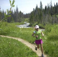
Kathleen on TalonNorth
We started on the southwest portion of the park and ascended to the Talons - a long climb through some diverse terrain that leads to two loops around the top - Talon North and Talon South. We ran both and they are quite spectacular trails with great views - East to the prairie and west to some undeveloped land that now belongs to CMSP - future trails are in discussions....
Talon North Summit - thick cloud behind us!
Traversing the Sundance Trail over toward Blackmer loop
After descending off the Talons, we made our way across Sundance and looped around to the bottom of the Blackmer loop. Time to climb again! It was really starting to warm up and the thick air was weighing on us, so we decided to stay higher with more trees - good call.
Going Up - ascending the Blackmer Trail
Got up onto Blackmer and found some nice shady trails that were tacky and a bit damp from Friday evening's storms. That is always a welcome change in this normally dry terrain. We did an extra loop on Cougar's Shadow, then rolled back across the top of Blackmer before starting the descent toward the trailhead.
Kathleen cruising down the front side of Blackmer
Parting Shot - Still no summit view!
On the way down, we took a detour on the Medicine Wheel trail, one of the more technical in the park. We figured we would keep our legs (and minds) honest to the very end of the run, testing our eye/foot coordination through and endless maze of boulders. It was a blast and we finished our run strong but tired. Very nice day on the trails!
Stats: 15 miles, 3000' elevation gain
Shoes: K - Saucony Guide Trail
S - Asics Trabuco
>>>>>>>>>>>>>>>>>>>>>
Sunday morning - cloudy again? Humid again? Yep, so we headed up the pass to Woodland Park and over to Rampart Reservoir. By the time we were half-way up Ute Pass, we were driving into partly sunny skies - nice! With the trailhead we use sitting above 9300' and the trail around the reservoir rolling at or above 9000', this run allows for some cooler temperatures in the summer and some good altitude training.
Spillway - and the start of the singletrack
Rushing water, wildflowers, and awesome trail
The trail starts up on Rampart Range Road and drops down immediately along the stream that brings water in off the mountains. Starting on a dirt road, we soon pick up a nice singletrack and cruise on down to the start of the loop around the reservoir. Surprisingly, we saw very few people on the trails today - odd but pleasant.
Above shoreline, running through the aspens
First views of Pikes Peak
Quiet Inlet
Kayakers enjoying some open water solitude and Peak views
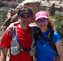
Happy Trails Duo
Once again today we had great conditions - last night's rains left the trails with a little more grip than normally found here. With a nice mixture of sun and clouds, cool breezes off the lake, and the soothing sounds of water lapping the shore below us, it was a great day to be running trails (of course, we think every day is a great day to be running trails...).
Almagre Mountain (Baldy) on the left, Pikes Peak on the right
Satellite view of the route
Although accumulated fatigue from back-to-back tough runs was apparent by the end, we had another great day running. Considering that a short half-hour drive puts us on the trail above 9000' elevation, this is a great little getaway right in our "backyard"! Hope everyone had a great weekend - Happy Trails!
We love trail running and biking in the mountains of Colorado and the desert Southwest. We enjoy spending time together, seeing new places, and meeting people who enjoy the outdoors like we do! We were thrown a little bit of a curve ball in March 2011 when Kathleen was diagnosed with Graves Disease, an auto-immune thyroid disorder. After trying to treat the disease with an anti-thyroid drug for a year and not achieving the results we had hoped for, she had radio-active iodine treatment (RAI) in February 2012 and is now in "wait and see" mode. We hope to have her back up and heading toward normal function some time during the summer of 2012 and back to true Happy Trailing. It has caused a little change of pace (slower) and a bit of a temporary life 'detour'. This is new and unexpected territory so the journey should be interesting, challenging, and hopefully still fun!
'To every thing there is a season, and a time to every purpose under the heaven.'
Ecclesiastes 3:1
Do all the good you can, By all the means you can, In all the ways you can, In all the places you can, At all the times you can, To all the people you can, As long as ever you can.-John Wesley
We will miss our sweet girl, Sage
Dec 1997 - Jun 2010
Weather
Followers
Watch your thoughts, for they become words. Watch your words, for they become actions. Watch your actions, for they become habits. Watch your habits, for they become character. Watch your character, for it becomes your destiny.