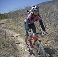
We wanted a little shorter run today so that we could do a hike with Sage after we finished. The Devisadero Loop showed 6 miles moderate singletrack so we thought we would have a crack at it. Once again the sun-soaked skies greeted us and painted a beautiful backdrop against the sage and pinyon covered hillsides east of town. We soon found out that moderate can be a highly subjective term. The initial flanks of Devisadero Peak were at times just short of brutal. Loose, technical footing and grades exceeding 20% made for a lung-burning climb for the first 2 miles.
The couple of short reprieves from the incline on the run up to the peak were not nearly enough to flush the lactate-induced fog from the quads!
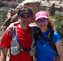
After three or four false summits, we finally reached the peak at 8304' where a nice "rest area" built of rock slabs awaited us. We stopped for a quick breath in the shade and a photo opp, then headed off to the east to continue the loop.
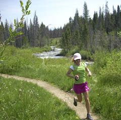
The gradual descent onto the back side of the peak was quite pleasant and the trail was fantastic as it contoured the mountain, never losing or gaining more than a few hundred feet elevation at a time. Most of this section was shaded during the run and at times we ran through 'tunnels' of scrub oak and pinyon trees.
After rounding the western shoulder of the mountain, we re-joined the trail where we had branched east on the ascent. Time for the tired quads to shed about 500 feet in half a mile of rocky descent - watch your step! This was definitely a 'Quads-O-Steel' route - 5.6 miles with nearly 1700' climbing, a large chunk of that coming in the first 2 miles. Good run and probably a locals' favorite for hill training!
We followed up our workout today by taking Sage for a 2 mile hike along a nice shaded trail. She loves to burn off some energy but she just gets too bored to run with us. She used to tolerate the running, but not any more - she's a Stop and Smell the Roses dog!!!
Tuesday, September 30, 2008
Monday, September 29, 2008
Classic Desert Singletrack
We headed to the hills southeast of downtown Taos to sample the Talpa Trail. Since the guide book showed this route as mostly singletrack skirting the hillside above town, we wanted to give it a shot. The run started up a steep abandoned jeep road before accessing the Talpa trailhead around .7 mile up. It was another awesome day and we were in for a great run on a roller-coaster trail.
The trail was pretty much normal fare for the desert running we have done: very rocky, in and out of many arroyos - steep down then right back up, and lots of winding through pinyon, juniper, and cactus. The singletrack was mostly narrow and twisty which always keeps you on your toes and not looking too far ahead!
We saw three people the entire time we were out today - 1 hiker and 2 horse riders - nothing like having the trail all to yourselves! All of the trails we sampled in Taos were in great condition and the trail users definitely do not abuse their land, which was very nice to see.
One of the open views to Taos Mountain along the trail.
Here we are powering up the last climb out to the road - almost downhill from here!!! This was a great desert run and another 8 miles of sweet trail running in fine, high-altitude sunshine - good times!!!
What's Inside:
New Mexico,
Talpa Trail,
Taos,
Trail Run
Sunday, September 28, 2008
Running the West Rim Trail
Sunday we drove west about 7 miles to the trailhead for the West Rim Trail. The trail follows the rim of the gorge formed by the Rio Grande River. The Rio Grande Gorge Bridge is quite the tourist attraction, and after about a mile, the trail was free from traffic. The trail runs about 9 miles south to the Orilla Verde Recreation area, where the trails are at river level.
We had a nice hiker snap a group photo before we started our run.
There was a bench that stuck out into the gorge about .5 mile into the run that looked back to a fantastic view of the bridge and the river far below.
The trail was a combination of single and double track, with a lot of rocks, and was fairly flat most of the way. Of course, at 7000' elevation, 'flat' is always a good profile for the first day of running in the high desert! Just behind Kathleen on the horizon is an all women's mountain bike group ride coming toward us with about 20 riders.
We saw a couple perched on a ledge meditating near this overlook - what an awesome sight to have while clearing the mind.
Fields of sagebrush and the mouth of the gorge in view in the background - pretty much a blueprint of the entire length of the trail that we ran. We went out about 4 miles and turned around for an 8 mile run. The breath-taking views along the way made this a fantastic outing with a little tourist factor thrown in for good measure!
Sunday evening we had a fantastic sunset to cap off a great day!
What's Inside:
New Mexico,
Taos,
Trail Run,
West Rim Trail
Saturday, September 27, 2008
The Sign Says it All ...
We had our fall vacation this week, so we decided to head down to Taos, New Mexico for some recreation and some relaxation. We have been to Taos several times but have not been down there since about 6 years ago. Aside from Bandelier National Monument in Los Alamos, we have not done any trail running in the area and were looking forward to a little dirt under foot!
We rented a nice casita on the Taos Mesa and had great views from the back patio. To the east, we had views of Taos Mountain, home to Taos Ski Valley. To the south and west, we had nice views of the Sangre De Cristo mountains.
Kathleen and Sage get settled in for a nice week in the sun. Forecast was for upper-70's to low 80's each day and it did not let us down!
Monday, September 22, 2008
In Search of Jones Park . . .
Becky made the suggestion of trying out a popular mountain bike trail in the southwest part of town, Jones Park, in Cheyenne Canon. A little different route than the normal route was recently profiled in our local paper so we thought we would try it today. For many people who ride Jones Park, it is a "shuttle" ride, ie mountain bikers get a ride to the top and ride the 14(?) or so miles DOWN to the bottom, ride terminus. If ridden as a loop, the total mileage is around 30ish miles. Since Becky and I are REAL mountain bikers (a little tongue-in-cheek here), we don't do shuttles or ski lifts to the top. We EARN our downhills by climbing to the top of mountains by our own power (picture a little muscle flexing). :-) So, with lots of water and fuel, and another perfect sunny bluebird day, we headed out in search of the Jones Park Downhill.
The ride starts out at the top of Cheyenne Canon, on Gold Camp Road. Gold Camp is a dirt/gravel road that is closed to cars for a nine mile stretch and is a gradual, steady middle ring climb on the bike. One of the reasons Gold Camp is closed to cars is due to one of the tunnels along this stretch collapsing. The picture above shows the gate to the closed, collapsed tunnel. The trail travels above the tunnel and then drops back down to Gold Camp.
Above is one of two good tunnels we ride through along Gold Camp. See the light at the end of the tunnel??? Wierd thoughts go through my mind whenever we ride through these, like: Are there bats waiting to swarm us? or, What was that big bump I just ran over but couldn't see??? Is there an ax murderer waiting in the shadows??? Hmmmm . . .
. . . and then by this little creek. Now we will have to drag the hubbies out so we can complete our search of Jones Park. No shuttle ride either! Hopefully you all will be able to get out and savor your rides and runs this weekend and earn your downhills! Happy Trails . . .
The ride starts out at the top of Cheyenne Canon, on Gold Camp Road. Gold Camp is a dirt/gravel road that is closed to cars for a nine mile stretch and is a gradual, steady middle ring climb on the bike. One of the reasons Gold Camp is closed to cars is due to one of the tunnels along this stretch collapsing. The picture above shows the gate to the closed, collapsed tunnel. The trail travels above the tunnel and then drops back down to Gold Camp.
Above is one of two good tunnels we ride through along Gold Camp. See the light at the end of the tunnel??? Wierd thoughts go through my mind whenever we ride through these, like: Are there bats waiting to swarm us? or, What was that big bump I just ran over but couldn't see??? Is there an ax murderer waiting in the shadows??? Hmmmm . . .
It was a gorgeous day! The aspens are just starting to change color.
We are about 11 miles in and nearing the top of the route (we think.). Yahooooo! Just a few miles to go! This is a nice view near the "top" with Colorado Springs in the distance. We have gained a fair amount of elevation. Gold Camp has joined with Old Stage Road and we are now looking for a "faint trail off to the right, near some cabins". Well, we found the "faint" trail. Or we think we found the "faint" trail.
R-I-G-H-T! It basically is a bunch of weeds sort of flattened out by maybe two people walking through (now four, since Becky and I walked up and through!). Basically, it is plain old bushwhacking. The "trail", ahem, then goes straight up - and over rocks, boulders, weeds, trees, bushes, whatever. We knew there was supposed to be a couple of "short" hike-a-bike sections, but, what defines short? A few feet? A 100 yards? A half mile? Three miles???? Personally, if I am going out for a hike, I don't care to wear stiff, hard plastic soled bike shoes with metal cleats in them. Although I LOVE to RIDE Mr. Mountain Bike, I do not care to push, carry, or hike with Mr. Mountain Bike up mountains. And by the looks of the terrain staring down at us - UH - OH. So there we are, Becky and I, not saying a word, just looking at this steep, tangled maze of so-called "trail". Hmmm, what to do? We don't want to give up and not get our just reward - the screaming fun downhill - but neither do we want to hike up THAT and potentially get lost. Nope. So we are both quiet, looking down at the ground, kicking around a little dirt . . . then Becky comes through and saves the day, "I need to make sure I get back in time to pick up the boys from school . . . if we keep going, do you think we can make it back in time and not get lost . . .". To which I answer with a sigh of relief," Yeah, it might be a good idea to head back the way we came and come back another time with our hubbies and have more time to explore." I look up and she's on her bike, down the little bushwhack trail, headed down the road!
So, we chickened out, turned around and headed back the way we came. Oh well. We still had tons of fun. We paused for a few pics by this little waterfall . . .. . . and then by this little creek. Now we will have to drag the hubbies out so we can complete our search of Jones Park. No shuttle ride either! Hopefully you all will be able to get out and savor your rides and runs this weekend and earn your downhills! Happy Trails . . .
What's Inside:
Cheyenne Cañon,
Colorado,
Gold Camp,
Mountain biking
Sunday, September 21, 2008
Sunday Stroll
The famous Kissing Camels rock formation at Garden of the Gods was perfectly framed against the fall sky to start our run today. Our day commenced with cloud cover but the sun broke through and we enjoyed the blue skies. Kathleen runs along the Dakota Trail here with the Kissing Camels in the background.
Steve near the top of the climb on the Palmer Trail. He was test driving his new visor for some better ventilation (or trying to emulate Bob out on the trails!!!) Don't know if I have quite the Heat Misor look going yet...
Kathleen concentrates on powering up the climb on the Palmer Trail.
Steve cruising the Ute Trail...
... and the Niobrara Trail.
The scenery was beautiful as always and with a great variety of rock formations and uniquely shaped trees, the Garden is always photogenic.
Nearing the end of our run, it was time for a group photo. We had another awesome day, with 9 miles of running and beautiful trails - definitely Good Times and Happy Trails!!!
What's Inside:
Colorado,
Garden of the Gods,
Trail Run
Saturday, September 20, 2008
Riding Day
Kathleen and Sage early on Saturday. Kathleen had to work, so she was heading out for a road ride near home and Steve was headed to Denver for a group ride.
Off and riding, Kathleen ended up riding 19 miles and had a good pace. It is amazing that as little riding as we have done this summer, we can still hop on and punch out some strong rides!
Meanwhile, Steve headed up to ride with some of the guys from the Océ North America Printing Systems office in Denver. The plan was to hook up at Curtis' home in the Greenwood Village area, head north through Cherry Creek and into the Downtown Denver/Confluence Park area, utilizing the Cherry Creek bike trail system. This was all new for me as we do not spend much time in the Denver metro area.
Steve, Curtis, Matt, and Dave getting some Colorado sun. We got in our ride as planned and got to see some of the competitors in the Crescent Moon Triathlon being held at Cherry Creek Reservoir. We also rode through the farmers market in Cherry Creek, where they were roasting some great smelling green chiles - almost good enough to quit riding and start eating!!! We reached our turn around point at the REI - Denver Flagship store, where one can be lured into purchasing all type of outdoor oriented goodies! We sat out on the deck for a bit while Matt and Dave took in a little Starbucks "fuel" for the return trip. With the brilliant sunshine, this hub of outdoor activity was buzzing and we soon made way for others to use the deck and started our return trip. It was a great ride and we ended up logging about 34 miles. Broken record here but we have almost limitless outdoor opportunities in our area and never cease to be amazed by all that we can enjoy. Denver metro has more parks per area than any city in the US and Colorado Springs ranks pretty high as well - very cool!
What's Inside:
Cherry Creek Trail,
Colorado,
Road biking
Tuesday, September 16, 2008
Racing Daylight
Denial can only go so far ... we are at that time of year where daylight and post-work runs are mixing less and less! We headed over to Palmer Park for an evening trail run and squeezed in some nice miles and warm temps. Steve got in a quick lap and Kathleen joined in when she arrived. We lost the sun behind Pikes Peak with about a mile to go so it was not too bad. Off in the distance, you can barely make out the red rock formations of Garden of the Gods against the mountains. It is nice not having a lot of skyscrapers to block the views around town!
Steve put together 7 miles and Kathleen 5, so it was a good weeknight trot. We saw a lot of folks out on the trails, so it appears everyone is trying to maximize their outdoor time. We'll take every night like this we can get and we might even consider some night running this fall - anyone have suggestions for good headlamps that work for trail running? We have done a bunch on bikes at night, but not really any runs. Get out and enjoy the trails!!!
Monday, September 15, 2008
Santa Fe Trail and AFA Ride Day
What a difference one day can make! Yesterday was gray, cloudy, and cool. Today was a a perfect day for a ride on the mountain bike. Brilliant blue skies and "just right" temperatures - 65 to start, 72 at the end - greeted us. Becky and I headed over to the Santa Fe Trail for a more mellow, non-technical ride.
I love the scene above. It is along the trail on the AFA. It is gorgeous. I wish there was a trail that meandered down into this area!
We stopped for a "group photo" near the area on the AFA where the cadets do some of their glider training. There is another area near this spot where they practice parachuting - that is very interesting to watch. Note SNOW covered Pikes Peak way in the background. That is SO wrong! :-)
We detoured from Santa Fe Trail and headed up "the dirt road climb". It is a dirt road that is about 3 miles long (??? - haven't measured it exactly in awhile) and climbs steadily, gaining about 1100 feet in elevation. In past years, (when Steve and I were in excellent mountain bike shape - which is not now!!! :-) ) we utilized this road frequently for our hill training. No hard intensity today - we just put it in a small gear and spun our way up and just enjoyed the beautiful day!
Kathleen heading up the climb. It is a beautiful setting!
We took a detour and did some exploring on a couple of the dirt roads that split off from "the dirt road climb". This particular road leads to the AFA stables and continues beyond. This section was a nice discovery because it is kind of flatish and is in and out of the trees. I forgot to take a photo at the top - the views are expansive and awe inspiring. We were both marveling at the beauty that we are so blessed to be surrounded by!
Time to head back down! We ended the day with around 27 miles. I thankfully savored the beauty and blessings of today - perfect weather, a beautiful area to live and play in, good health so that I am able to get out to ride, run, and enjoy all our area has to offer, my wonderful friends like Becky, and an awesome hubby! Not much more to ask for! Happy Trails to all this week!
What's Inside:
Colorado,
Mountain biking,
Santa Fe Trail,
US Air Force Academy
Sunday, September 14, 2008
Nice Run at Falcon Trail
After running early yesterday in the cold due to schedule, we decided to get in a long run today at the Falcon Trail. Weather forecast was for sunny and 64, but we were treated to cloudy and 49 - guess you can't always have great trails and weather on the same day. We were just glad it never rained because it certainly could have at any time.
Kathleen trying to get warmed up at the start of the run right behind Falcon Stadium. Aside from the back side climb where it got a little cool, it was surprisingly comfortable running today even though we still have our summer "skin".
Grinding up the climb on the back side of the loop. With 4 climbs and over 2000' elevation gain on the loop, the climb up the back side is the longest and most difficult.
You can see the water treatment facility for the Air Force Academy in the background as Steve continues the climb. The trails were in great shape after some more nice rain we had Thursday and Friday.
Cruising some sweet singletrack makes you forget about the clouds.
Climbing is finished ... time for some great downhill! The trails were pretty quiet today - must be that no one is ready for this kind of weather yet.
We had a great day today and accomplished one of our summer goals - we ran the loop sub-2 hours and topped our previous best time by almost 8 minutes! Happy Trails!
What's Inside:
Colorado,
Falcon Trail,
Trail Run,
US Air Force Academy
Subscribe to:
Posts (Atom)